Vous devez activer Javascript pour pouvoir afficher correctement cette page !
Accueil / Recherche
|
Les photos en France
|
Les photos des autres pays
|
Envoyer vos photos
|
Le TOP 20
Conditions d'utilisation
|
Google Maps
|
Formulaire de contact
|
Nouvelles photos ajoutées
|
Newsletter
Publicité :
Nombre de photo(s) :
55
Lancer le
diaporama
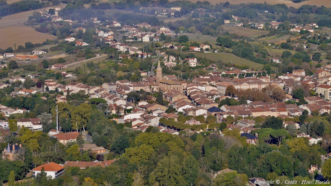
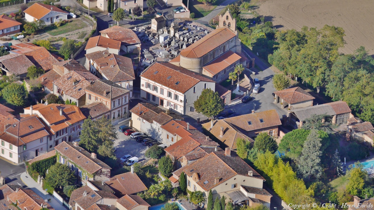
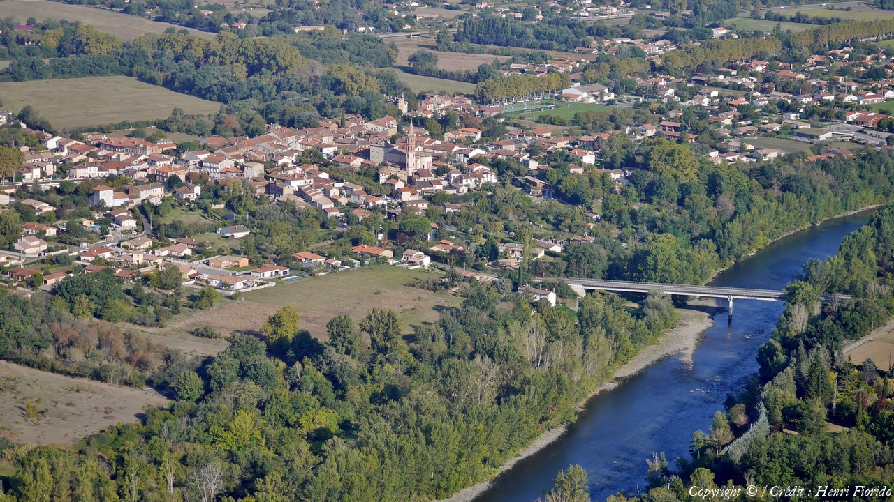
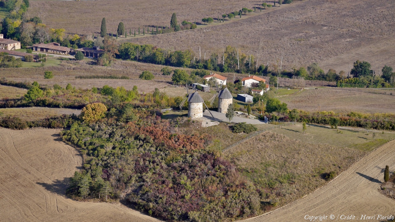
Pays :
France
Département :
Haute-Garonne (31)
Lieu :
Capens
Coord. GPS :
43 20 11 N 01 15 27 E
Photographe :
Henri Fiorido
Prise le :
24/09/2017
Vue 1746 fois (
0.72 fois/jour
)
Affiner la recherche
-
Situer sur la carte
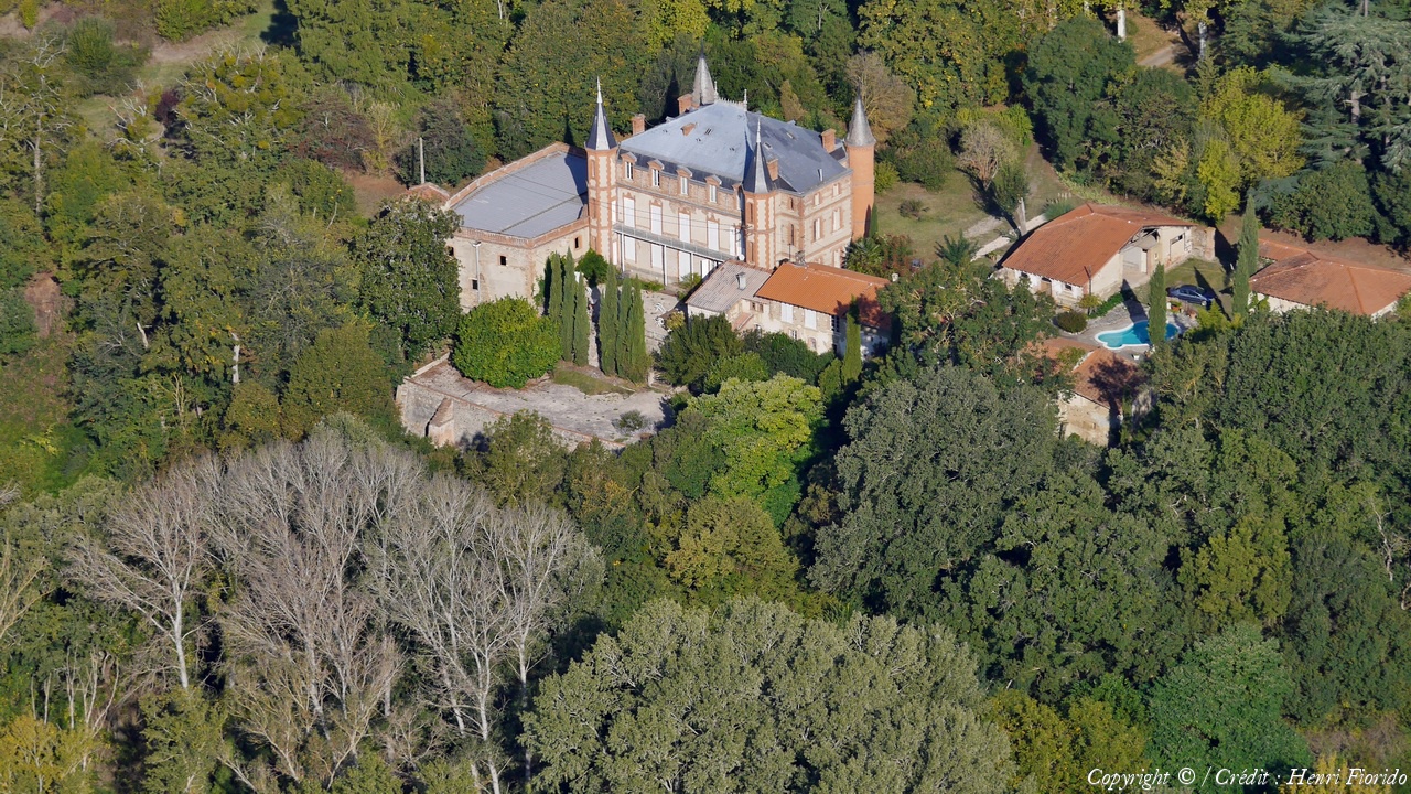
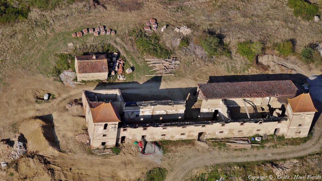
Pays :
France
Département :
Haute-Garonne (31)
Lieu :
Capens
Coord. GPS :
43 20 25 N 01 15 41 E
Photographe :
Henri Fiorido
Prise le :
24/09/2017
Vue 2020 fois (
0.83 fois/jour
)
Affiner la recherche
-
Situer sur la carte
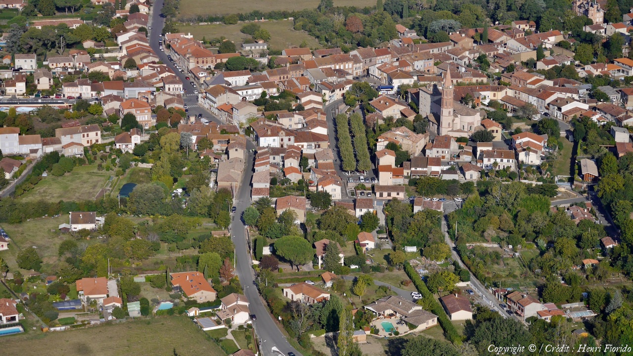
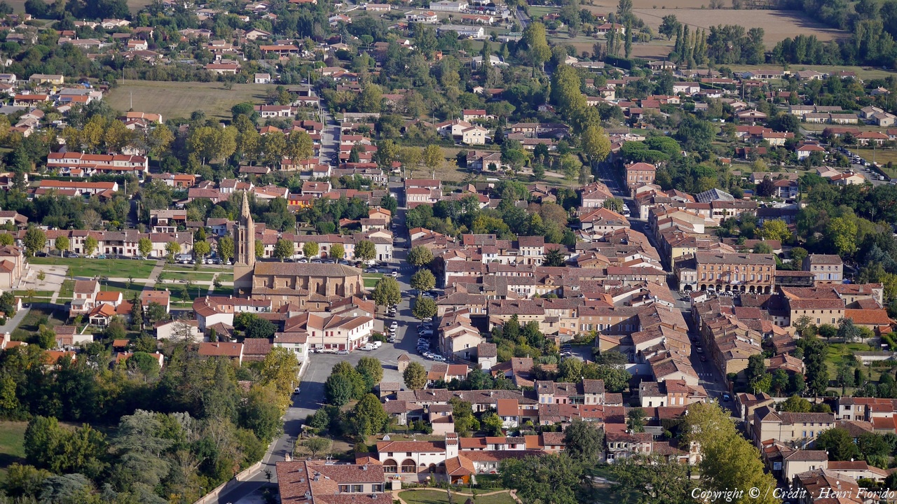
Pays :
France
Département :
Haute-Garonne (31)
Lieu :
Noe
Coord. GPS :
43 20 59 N 01 16 53 E
Photographe :
Henri Fiorido
Prise le :
24/09/2017
Vue 1603 fois (
0.66 fois/jour
)
Affiner la recherche
-
Situer sur la carte
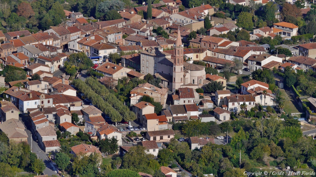
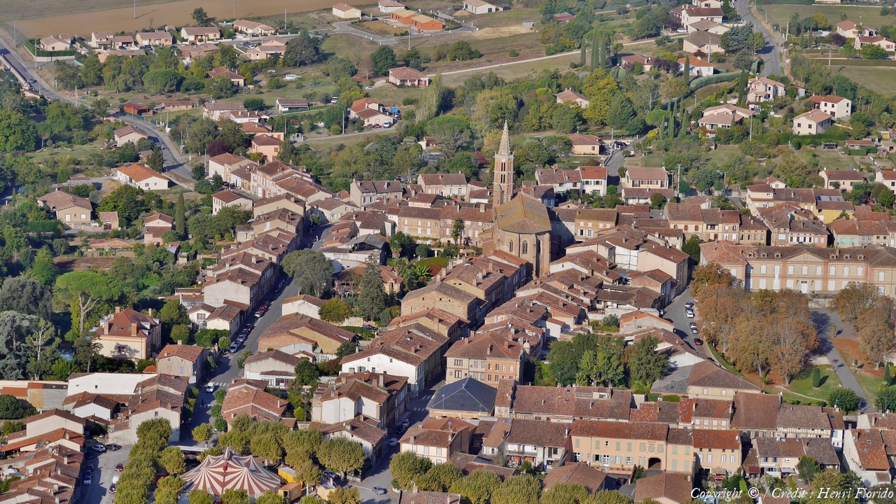
Pays :
France
Département :
Haute-Garonne (31)
Lieu :
Noe
Coord. GPS :
43 20 59 N 01 16 53 E
Photographe :
Henri Fiorido
Prise le :
24/09/2017
Vue 1638 fois (
0.68 fois/jour
)
Affiner la recherche
-
Situer sur la carte
Pays :
France
Département :
Haute-Garonne (31)
Lieu :
Noe
Coord. GPS :
43 20 59 N 01 16 53 E
Photographe :
Henri Fiorido
Prise le :
24/09/2017
Vue 1456 fois (
0.60 fois/jour
)
Affiner la recherche
-
Situer sur la carte
Pays :
France
Département :
Haute-Garonne (31)
Lieu :
Saint-Sulpice-sur-Lèze
Coord. GPS :
43 19 28 N 01 18 55 E
Photographe :
Henri Fiorido
Prise le :
24/09/2017
Vue 1556 fois (
0.64 fois/jour
)
Affiner la recherche
-
Situer sur la carte
Pays :
France
Département :
Haute-Garonne (31)
Lieu :
Saint-Sulpice-sur-Lèze
Coord. GPS :
43 19 43 N 01 19 21 E
Photographe :
Henri Fiorido
Prise le :
24/09/2017
Vue 1351 fois (
0.56 fois/jour
)
Affiner la recherche
-
Situer sur la carte
Pays :
France
Département :
Ariège (09)
Lieu :
Lézat-sur-Lèze
Coord. GPS :
43 16 34 N 01 20 47 E
Photographe :
Henri Fiorido
Prise le :
24/09/2017
Vue 1318 fois (
0.54 fois/jour
)
Affiner la recherche
-
Situer sur la carte
Pays :
France
Département :
Ariège (09)
Lieu :
Lézat-sur-Lèze
Coord. GPS :
43 16 18 N 01 21 48 E
Photographe :
Henri Fiorido
Prise le :
24/09/2017
Vue 1116 fois (
0.46 fois/jour
)
Affiner la recherche
-
Situer sur la carte
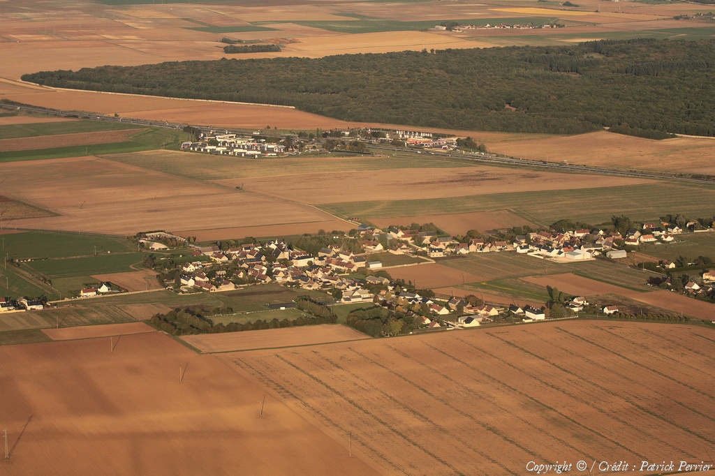
Pays :
France
Département :
Loir-et-Cher (41)
Lieu :
Villerbon
Coord. GPS :
47 39 43 N 01 22 23 E
Photographe :
Patrick Perrier
Prise le :
24/09/2017
Vue 1586 fois (
0.65 fois/jour
)
Affiner la recherche
-
Situer sur la carte
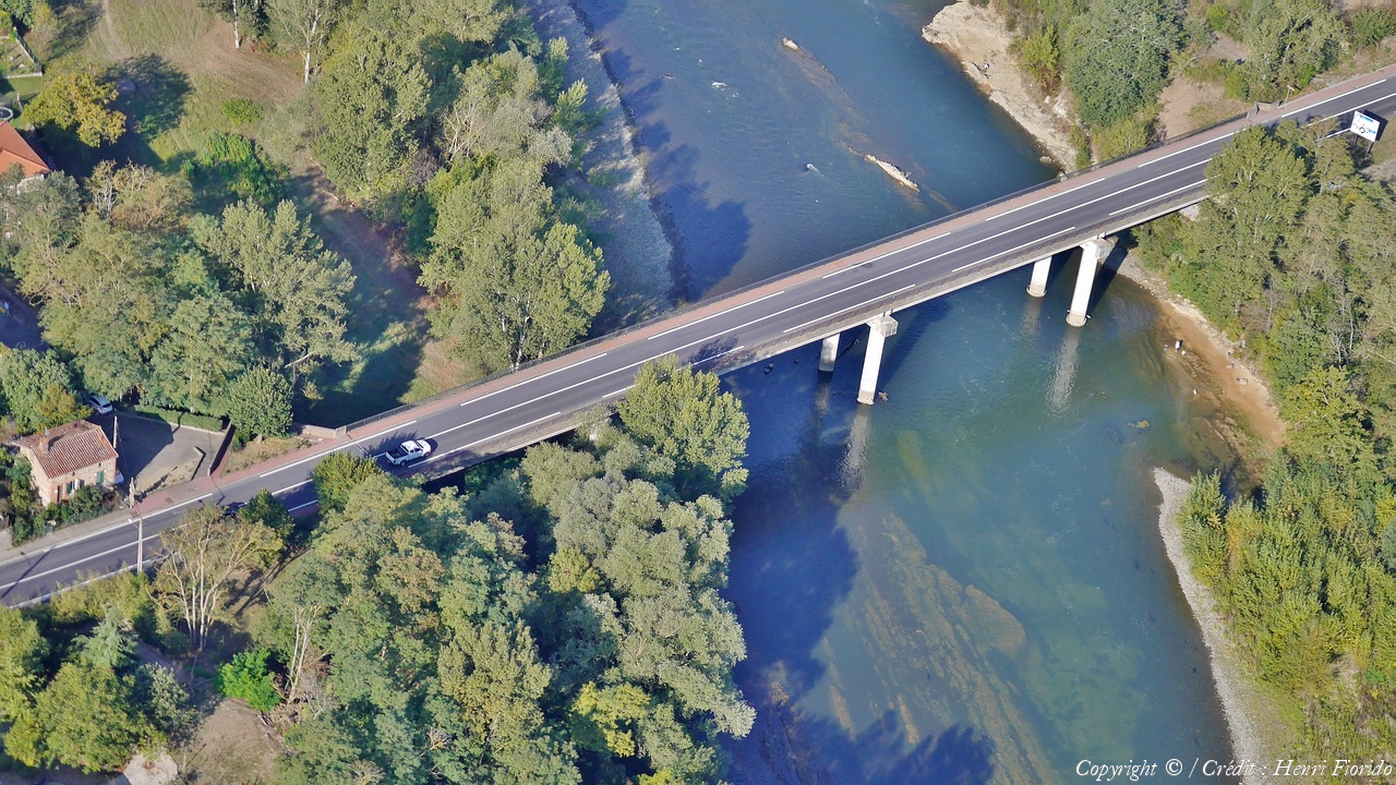
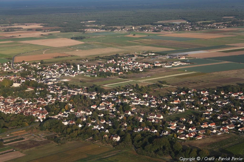
Pays :
France
Département :
Loir-et-Cher (41)
Lieu :
Montlivault
Coord. GPS :
47 38 20 N 01 26 40 E
Photographe :
Patrick Perrier
Prise le :
24/09/2017
Vue 1486 fois (
0.61 fois/jour
)
Affiner la recherche
-
Situer sur la carte
Pays :
France
Département :
Loir-et-Cher (41)
Lieu :
Menars
Coord. GPS :
47 38 27 N 01 24 34 E
Photographe :
Patrick Perrier
Prise le :
24/09/2017
Vue 1616 fois (
0.67 fois/jour
)
Affiner la recherche
-
Situer sur la carte
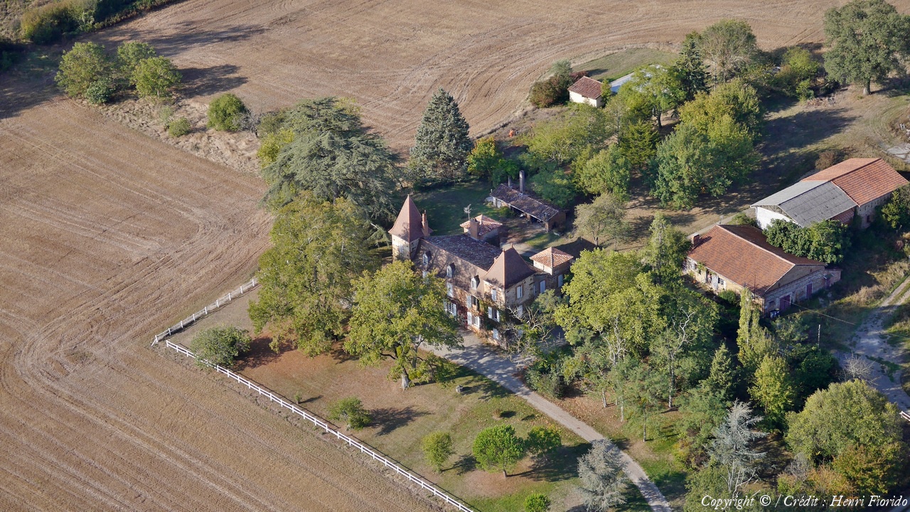
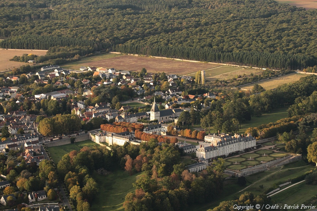
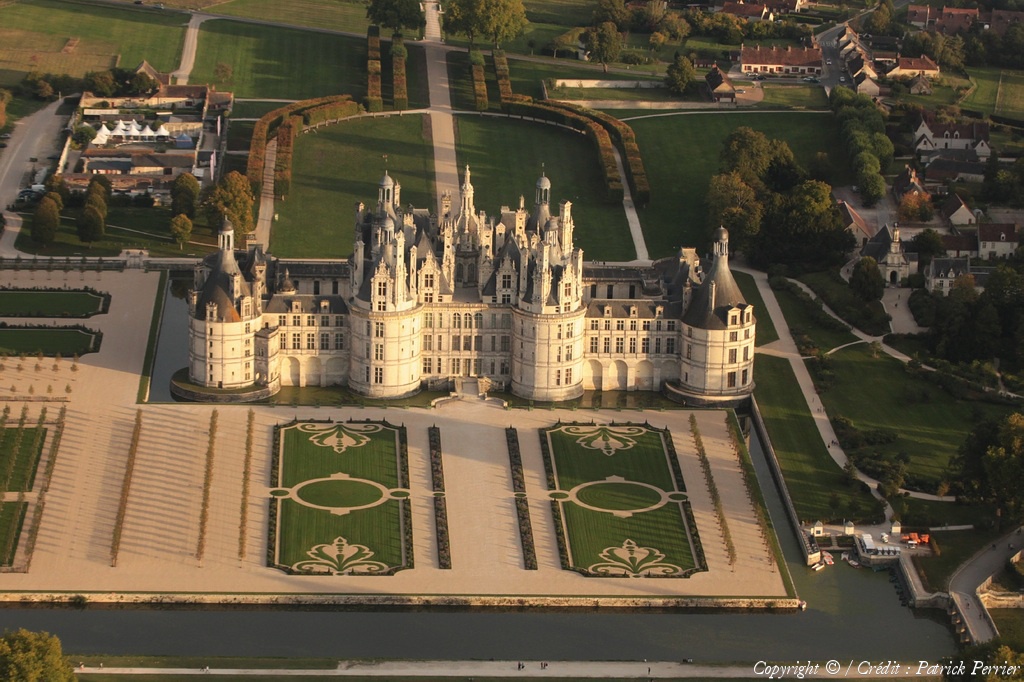
Pays :
France
Département :
Loir-et-Cher (41)
Lieu :
Château de Chambord
Coord. GPS :
47 36 56 N 01 31 00 E
Photographe :
Patrick Perrier
Prise le :
24/09/2017
Vue 1457 fois (
0.60 fois/jour
)
Affiner la recherche
-
Situer sur la carte
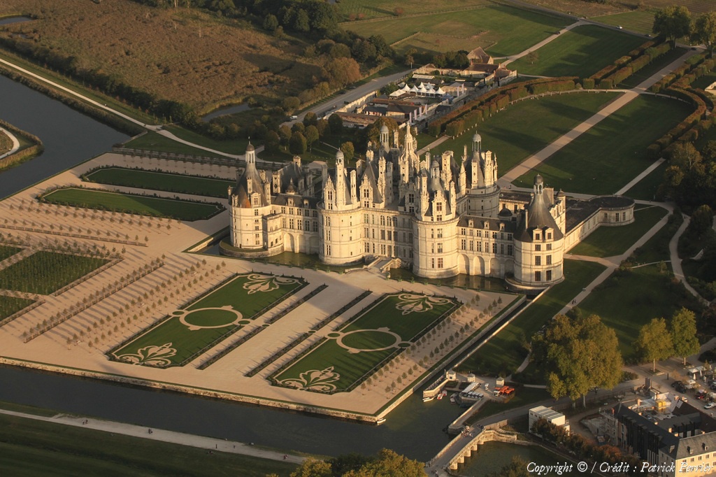
Pays :
France
Département :
Loir-et-Cher (41)
Lieu :
Château de Chambord
Coord. GPS :
47 36 56 N 01 31 00 E
Photographe :
Patrick Perrier
Prise le :
24/09/2017
Vue 1369 fois (
0.56 fois/jour
)
Affiner la recherche
-
Situer sur la carte
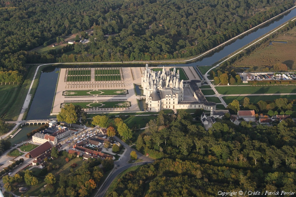
Pays :
France
Département :
Loir-et-Cher (41)
Lieu :
Château de Chambord
Coord. GPS :
47 36 56 N 01 31 00 E
Photographe :
Patrick Perrier
Prise le :
24/09/2017
Vue 1206 fois (
0.50 fois/jour
)
Affiner la recherche
-
Situer sur la carte
Pays :
France
Département :
Loir-et-Cher (41)
Lieu :
Château de Chambord
Coord. GPS :
47 36 56 N 01 31 00 E
Photographe :
Patrick Perrier
Prise le :
24/09/2017
Vue 1157 fois (
0.48 fois/jour
)
Affiner la recherche
-
Situer sur la carte
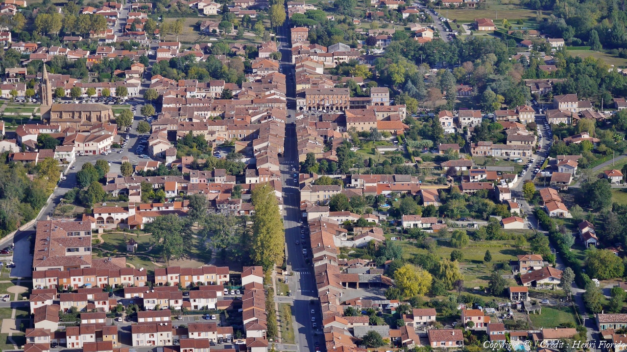
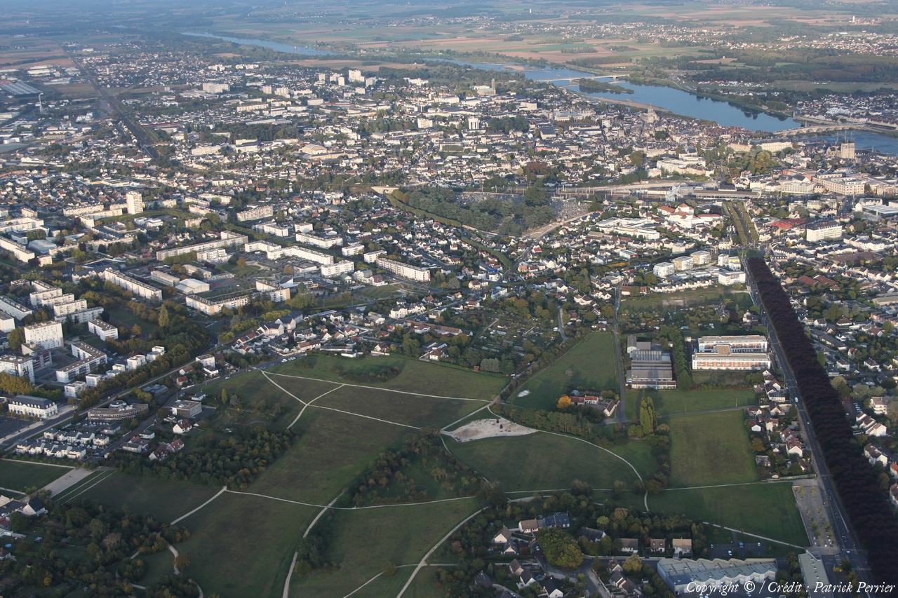
Pays :
France
Département :
Loir-et-Cher (41)
Lieu :
Blois
Coord. GPS :
47 35 07 N 01 19 54 E
Photographe :
Patrick Perrier
Prise le :
24/09/2017
Vue 1668 fois (
0.69 fois/jour
)
Affiner la recherche
-
Situer sur la carte
Pays :
France
Département :
Loir-et-Cher (41)
Lieu :
Blois
Coord. GPS :
47 35 07 N 01 19 54 E
Photographe :
Patrick Perrier
Prise le :
24/09/2017
Vue 1743 fois (
0.72 fois/jour
)
Affiner la recherche
-
Situer sur la carte
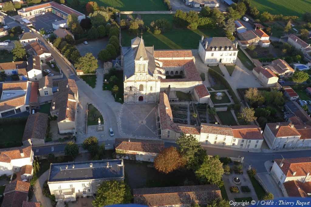
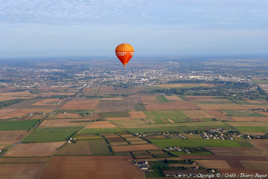
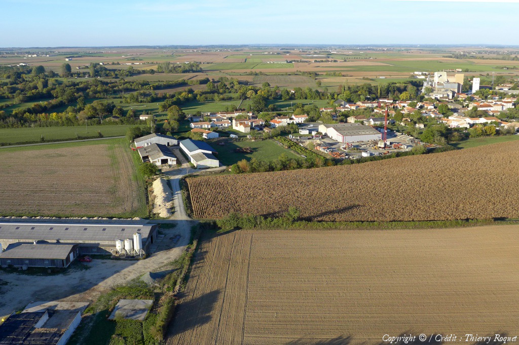
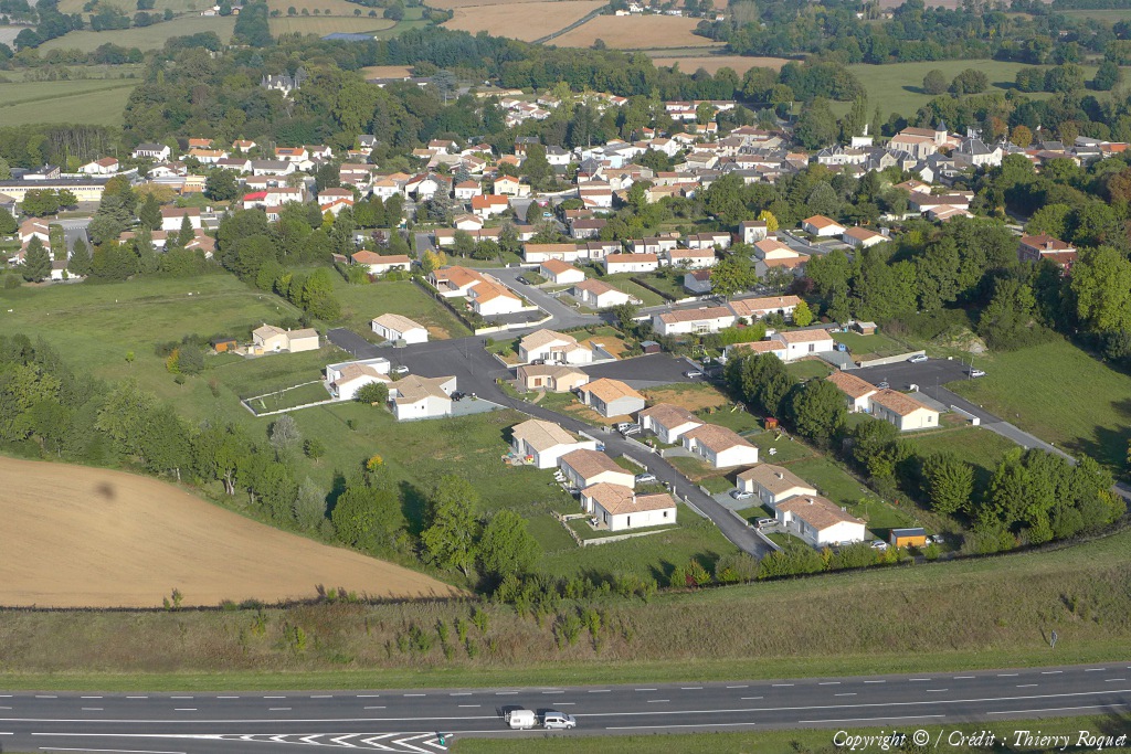
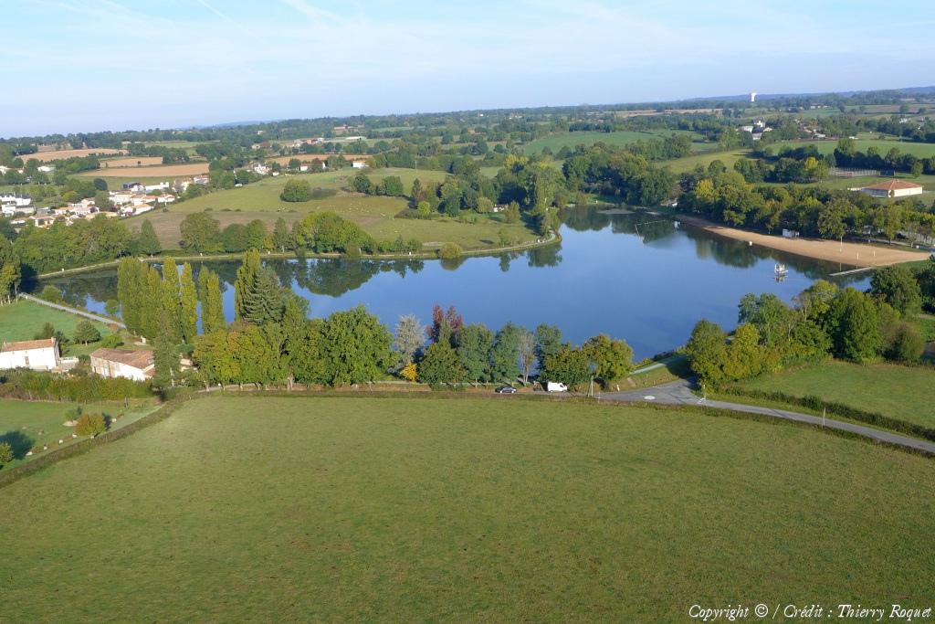
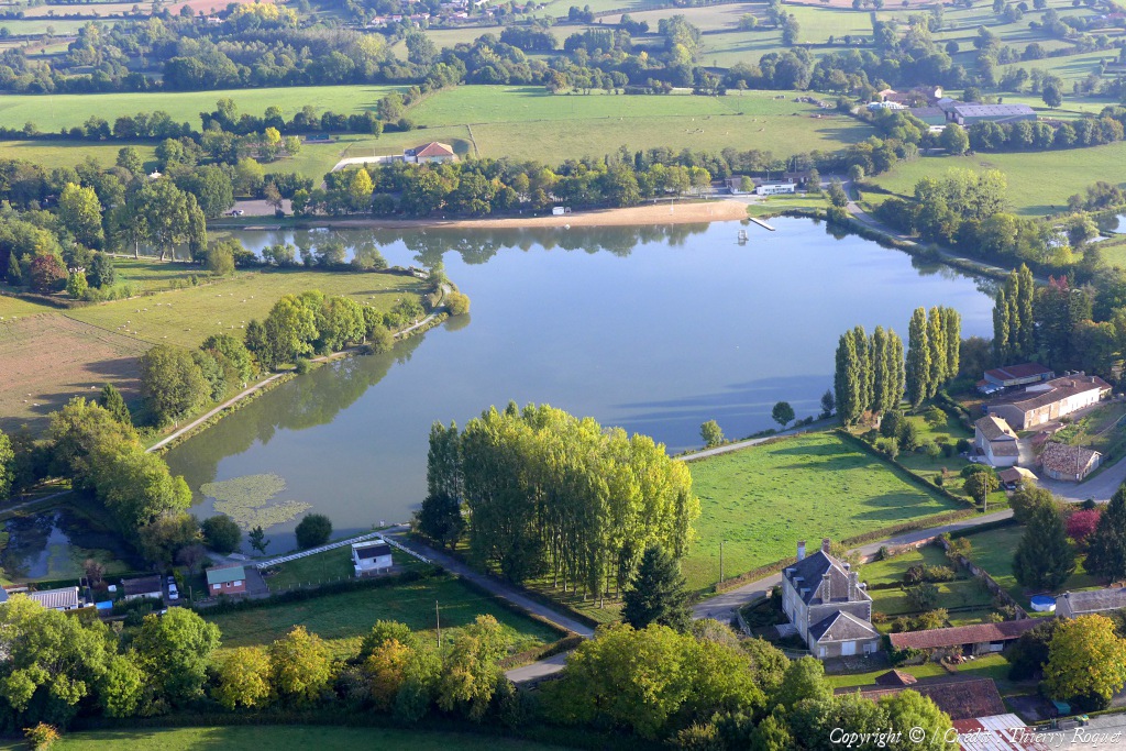
Pays :
France
Département :
Deux-Sèvres (79)
Lieu :
Mazières-en-Gâtine
Coord. GPS :
46 31 48 N 00 19 15 W
Photographe :
Thierry Roquet
Prise le :
24/09/2017
Vue 1248 fois (
0.51 fois/jour
)
Affiner la recherche
-
Situer sur la carte
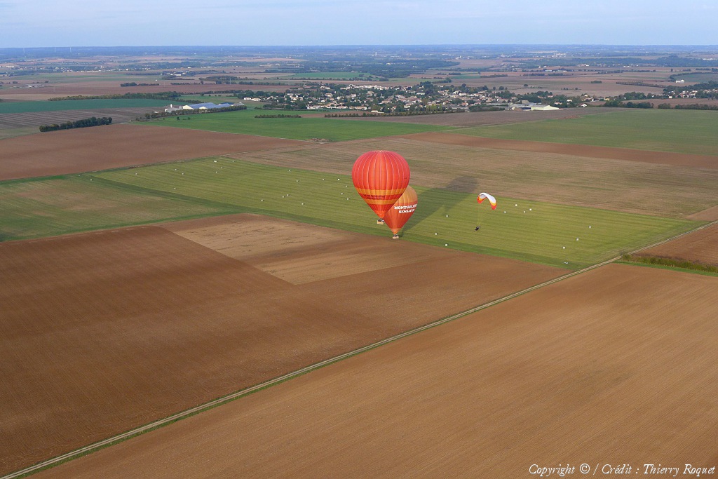
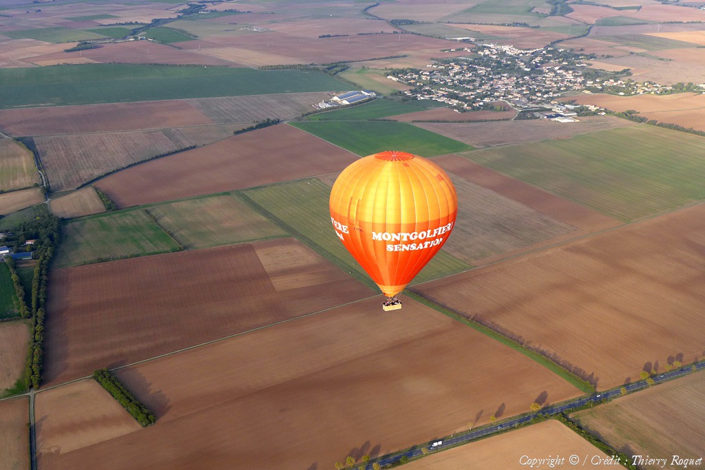
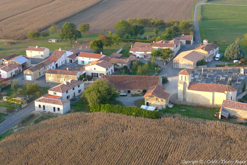
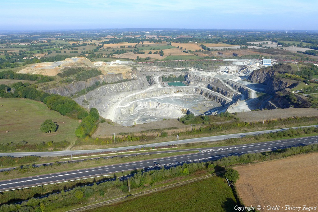
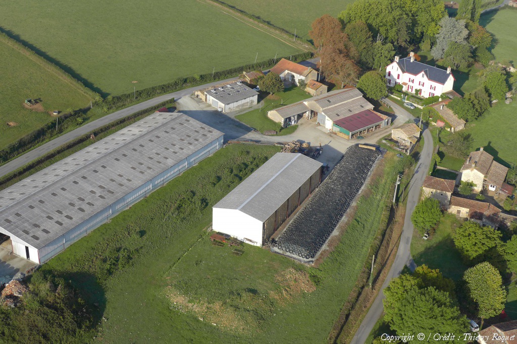
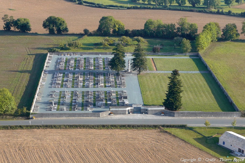
Pays :
France
Département :
Deux-Sèvres (79)
Lieu :
Mazières-en-Gâtine
Coord. GPS :
46 31 40 N 00 19 26 W
Photographe :
Thierry Roquet
Prise le :
24/09/2017
Vue 1282 fois (
0.53 fois/jour
)
Affiner la recherche
-
Situer sur la carte
Première page
Page précédente
1
2
3
Page suivante
Dernière page
Droits réservés - Copyright ©
Survol de France
Site en ligne depuis le 28 octobre 2004
375 visiteurs en ligne
-
2943 visiteurs aujourd'hui
Information sur la confidentialité
-
Mentions légales
Mesure d'audience ROI frequentation par


