Vous devez activer Javascript pour pouvoir afficher correctement cette page !
Accueil / Recherche
|
Les photos en France
|
Les photos des autres pays
|
Envoyer vos photos
|
Le TOP 20
Conditions d'utilisation
|
Google Maps
|
Formulaire de contact
|
Nouvelles photos ajoutées
|
Newsletter
Publicité :
Nombre de photo(s) :
39
Lancer le
diaporama
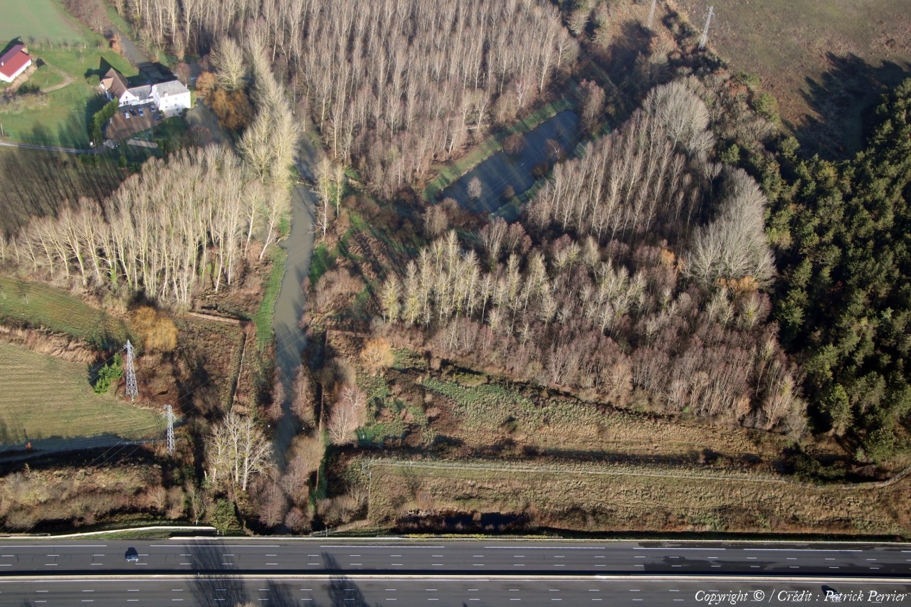
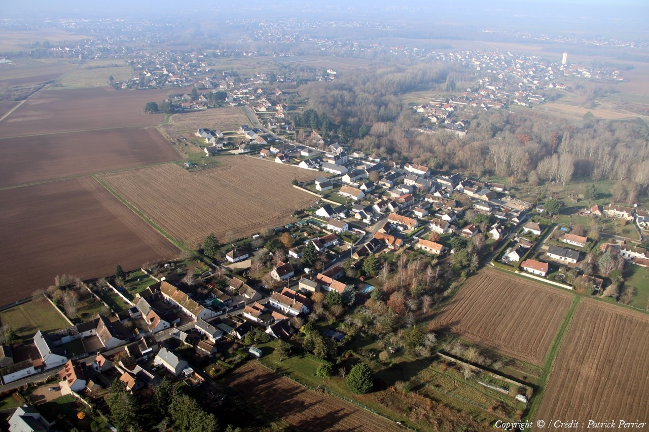
Pays :
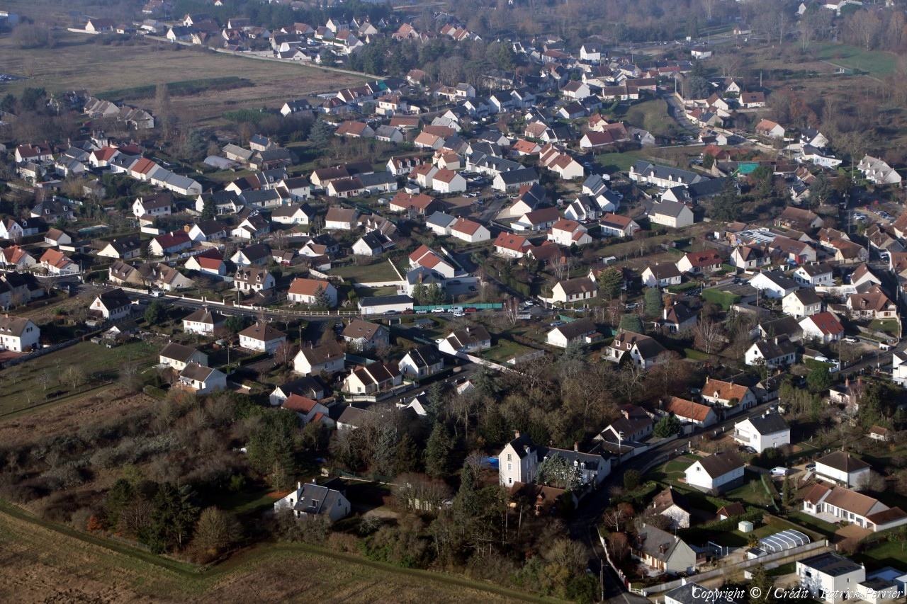
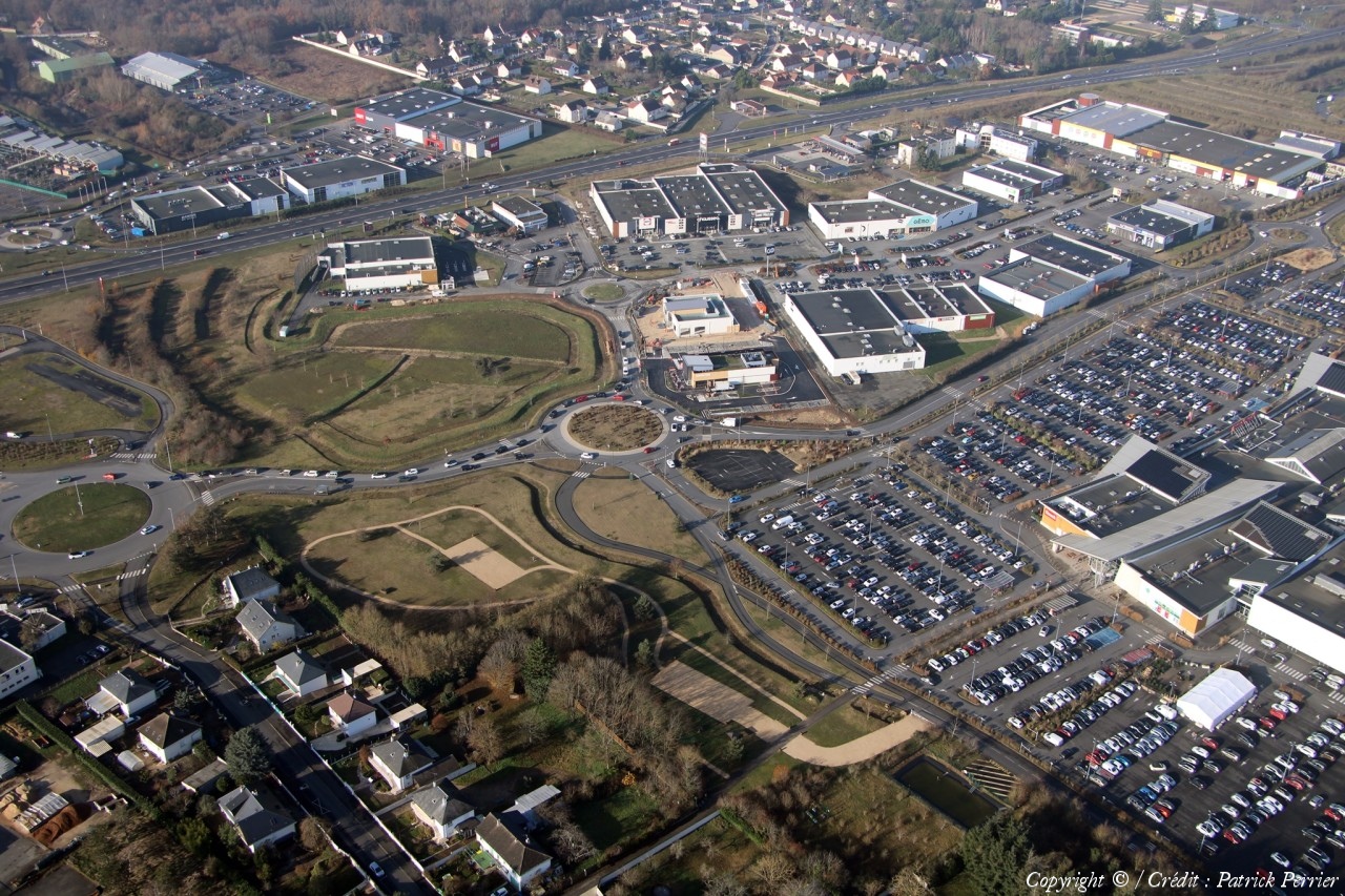
France
Département :
Loir-et-Cher (41)
Lieu :
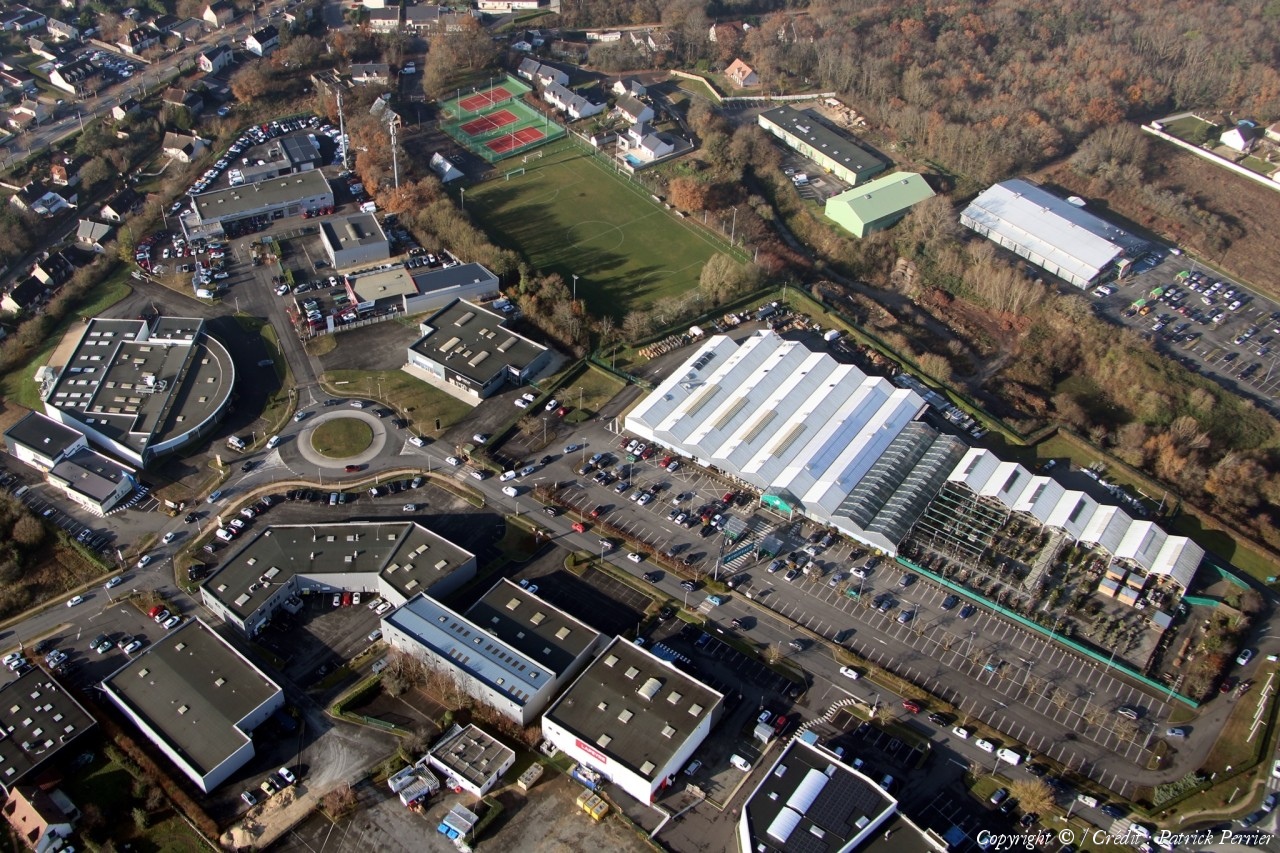
Vineuil
Coord. GPS :
47 34 52 N 01 22 30 E
Photographe :
Patrick Perrier
Prise le :
16/12/2023
Vue 74 fois (
0.78 fois/jour
)
Affiner la recherche
-
Situer sur la carte
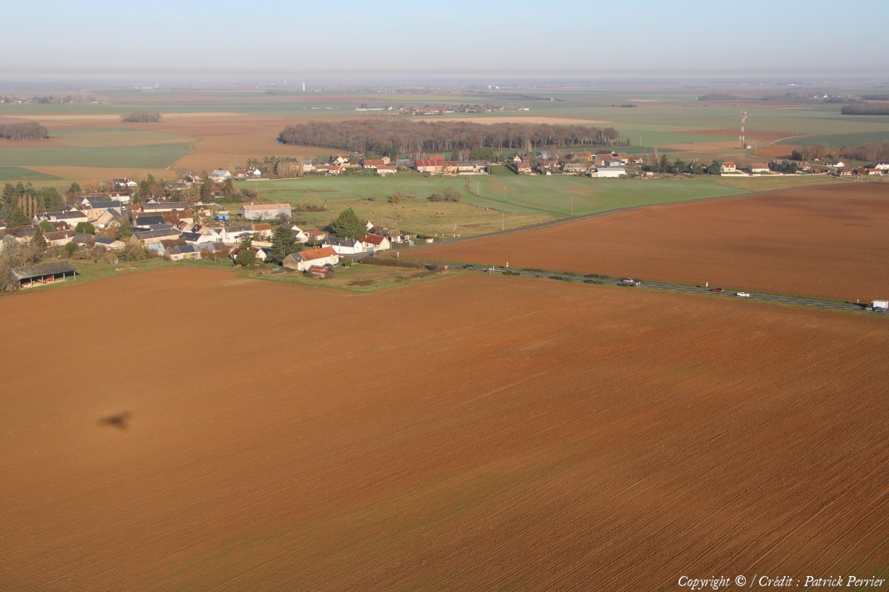
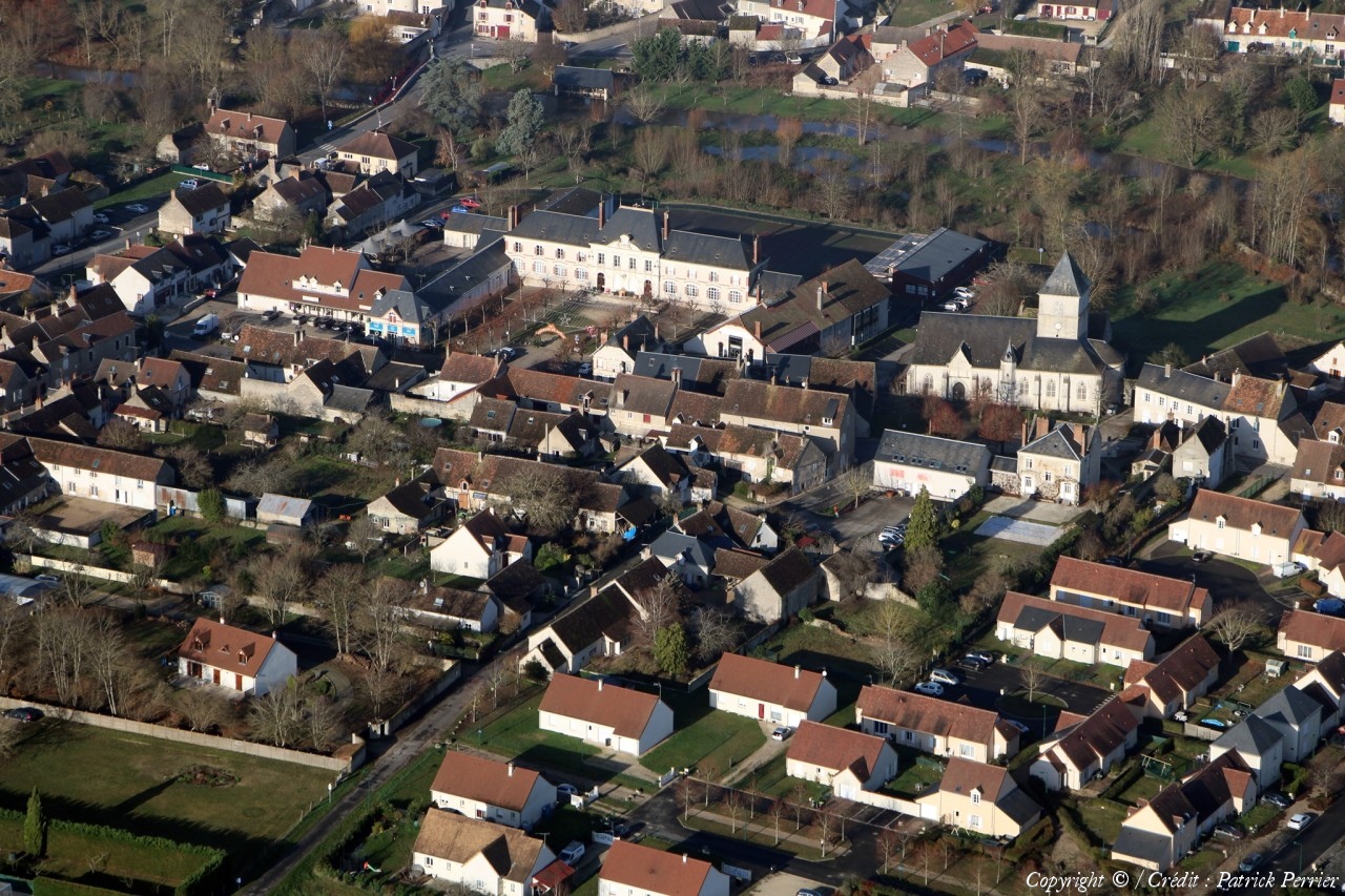
Pays :
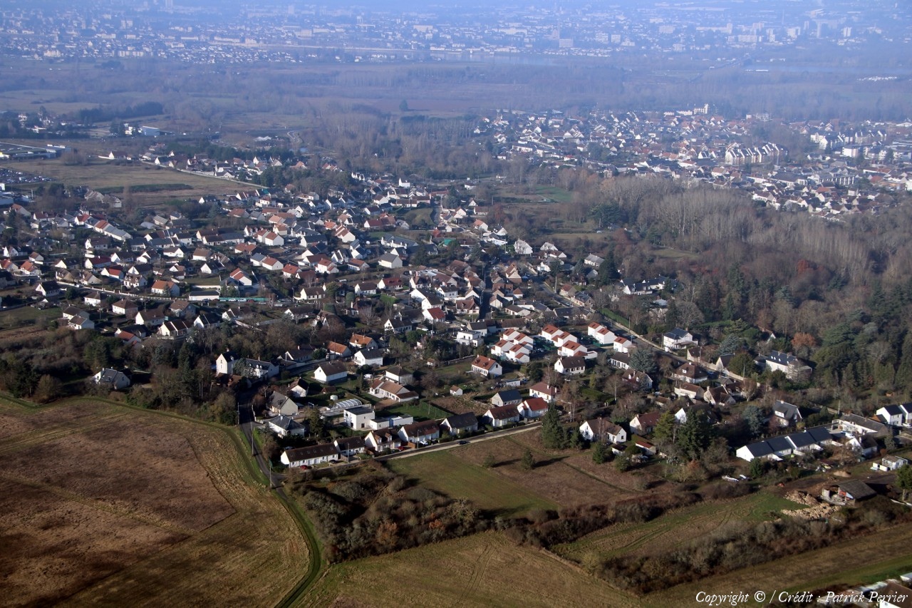
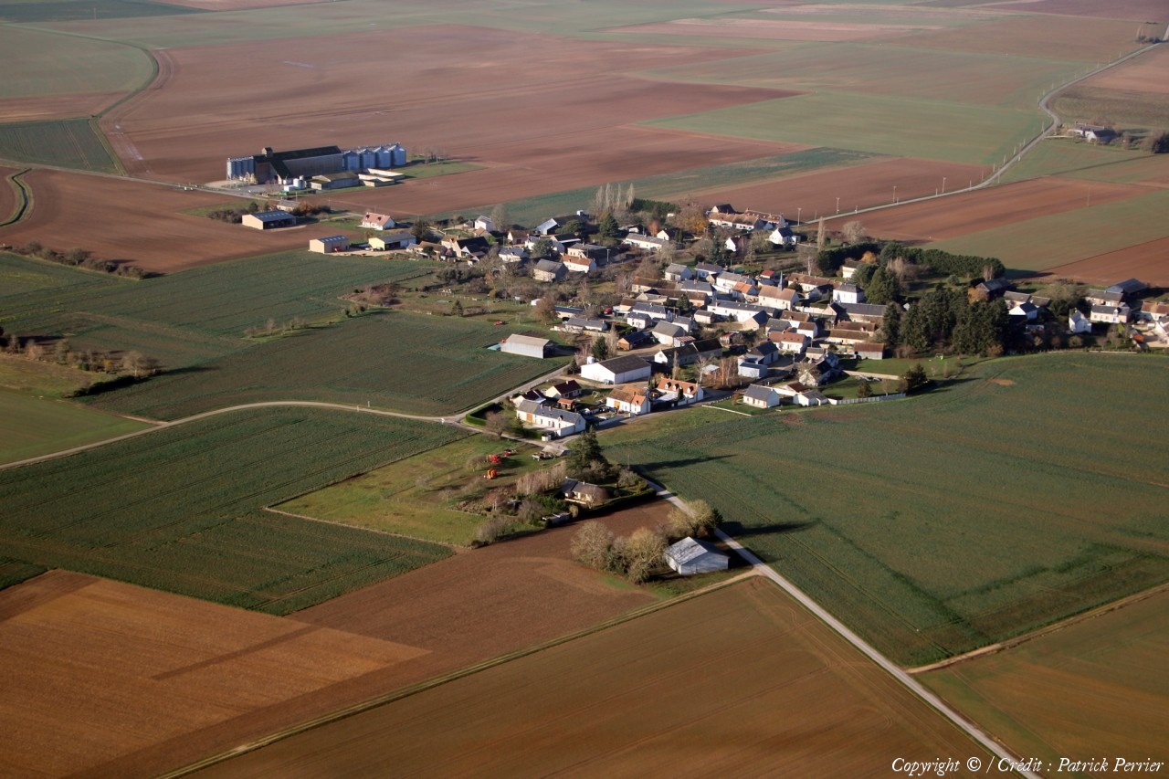
France
Département :
Loir-et-Cher (41)
Lieu :
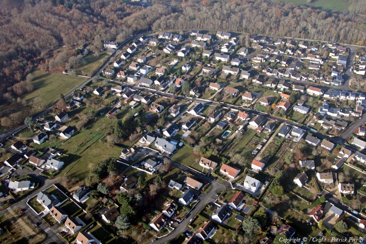
Tourailles
Coord. GPS :
47 41 06 N 01 09 31 E
Photographe :
Patrick Perrier
Prise le :
16/12/2023
Vue 92 fois (
0.97 fois/jour
)
Affiner la recherche
-
Situer sur la carte
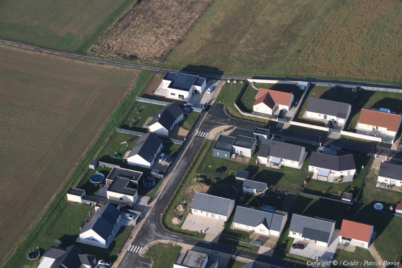
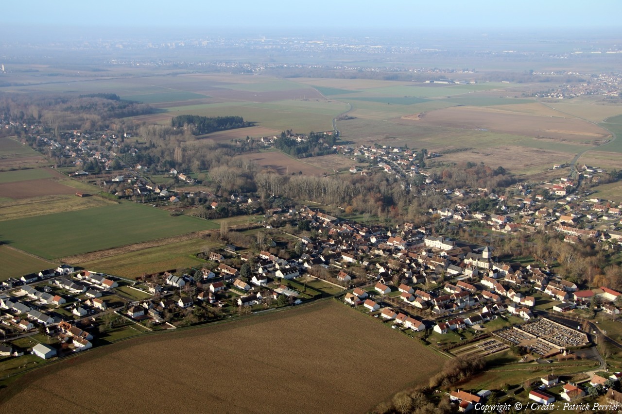
Pays :
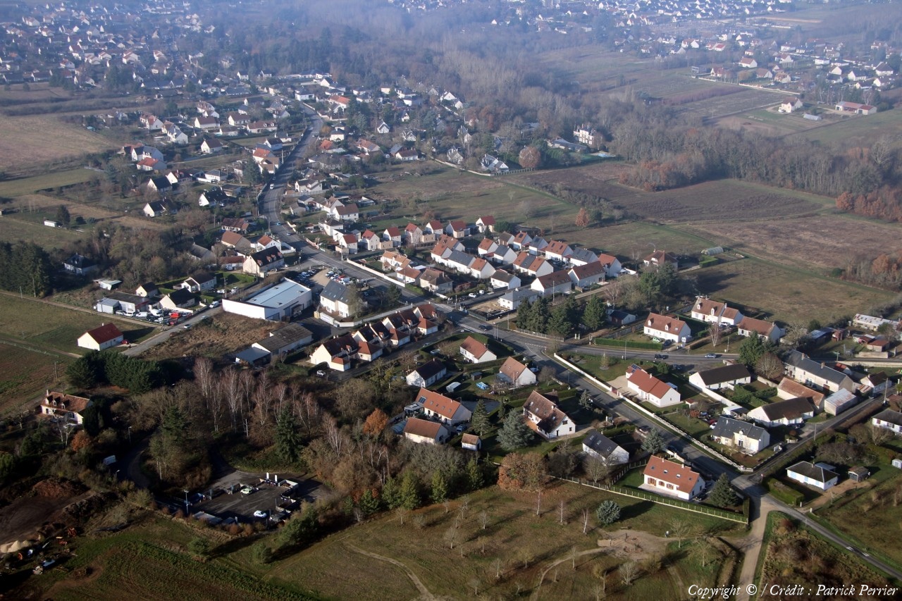
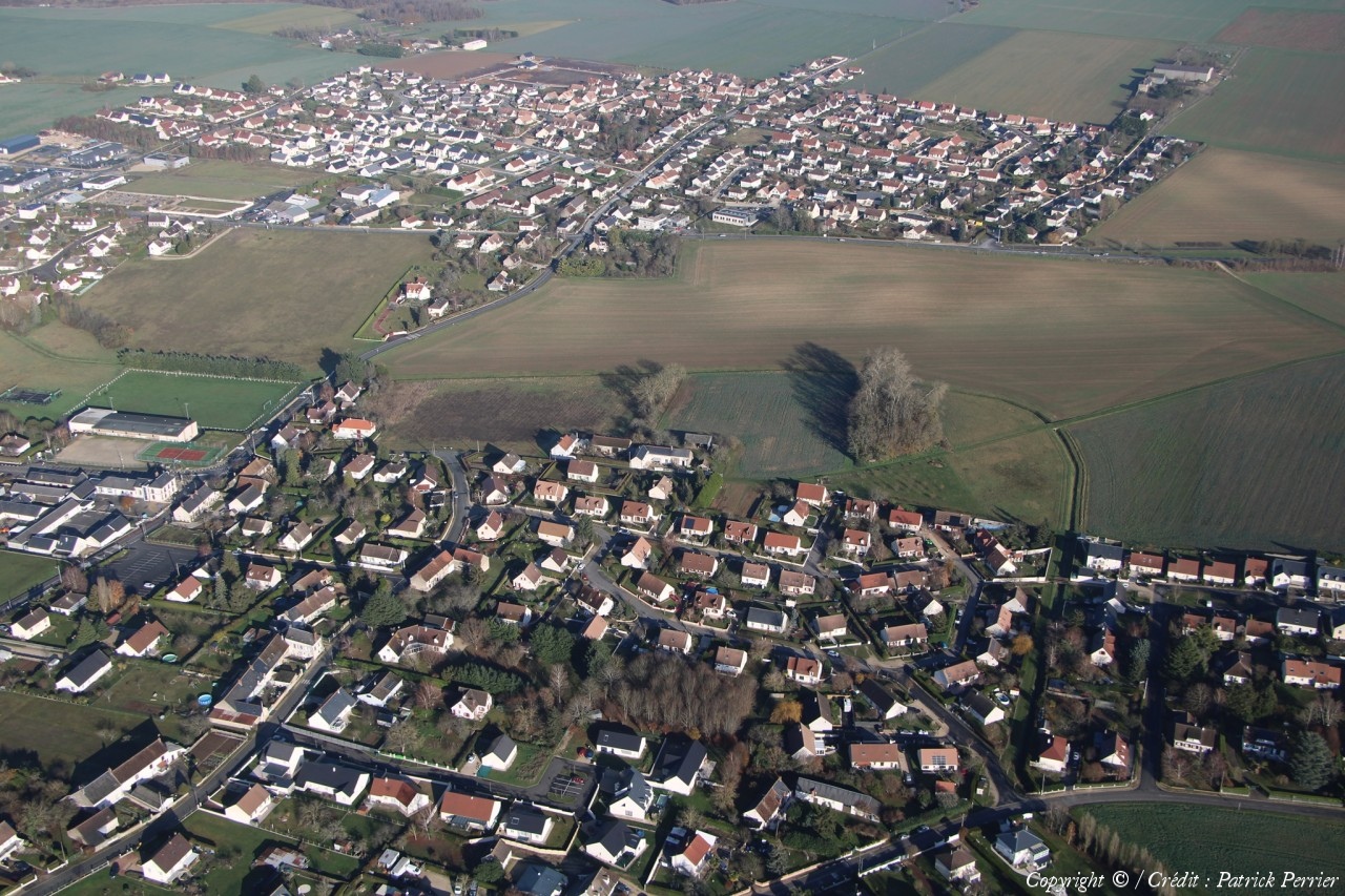
France
Département :
Loir-et-Cher (41)
Lieu :
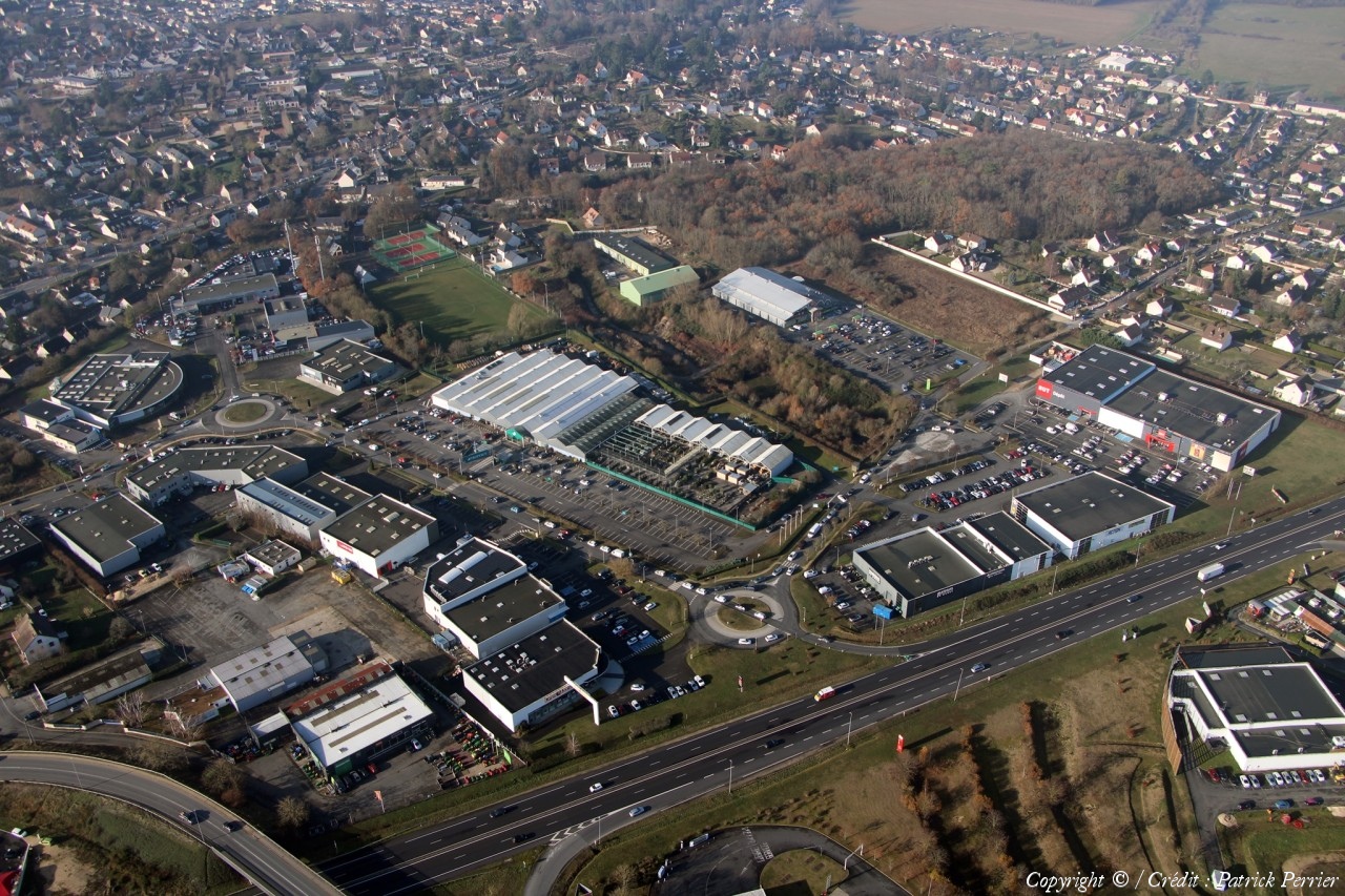
Saint-sulpice-de-Pommeray
Coord. GPS :
47 36 12 N 01 15 47 E
Photographe :
Patrick Perrier
Prise le :
16/12/2023
Vue 77 fois (
0.81 fois/jour
)
Affiner la recherche
-
Situer sur la carte
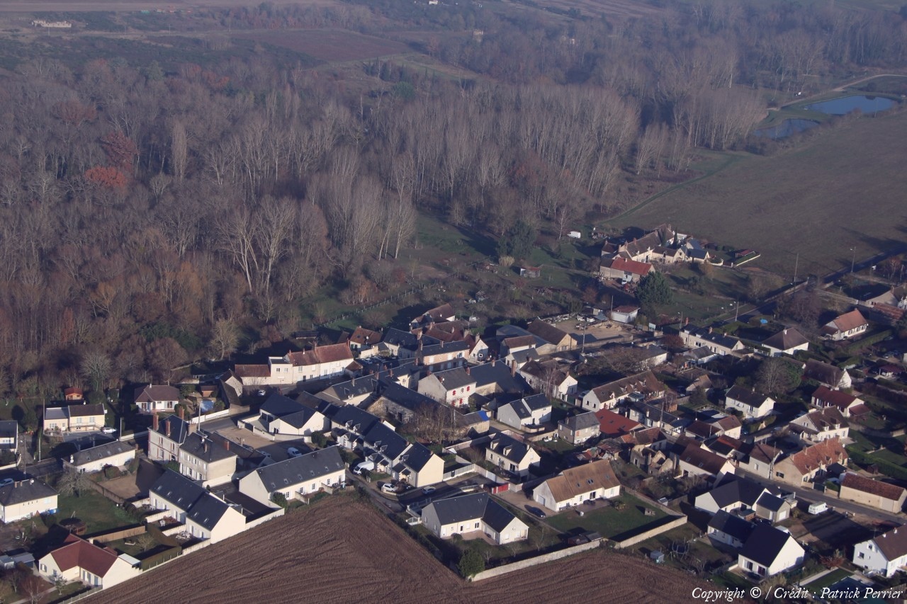
Pays :
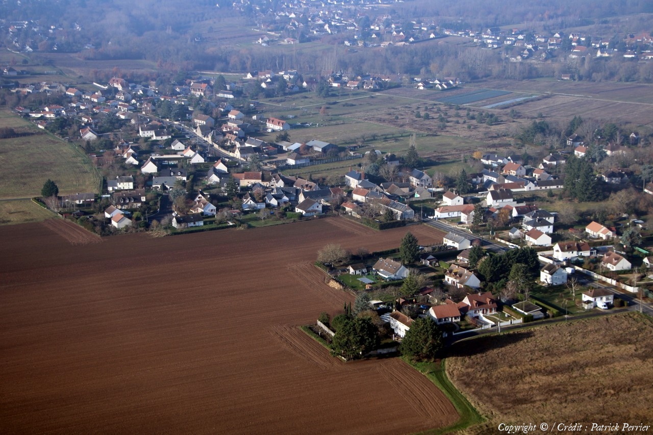
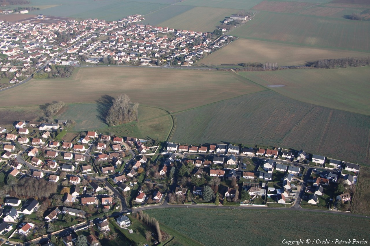
France
Département :
Loir-et-Cher (41)
Lieu :
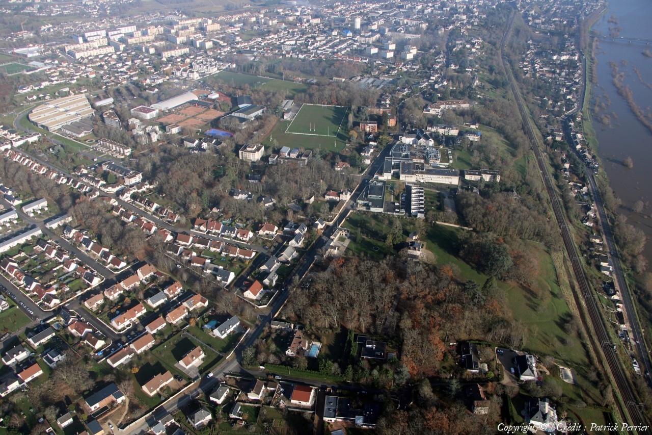
Saint-sulpice-de-Pommeray
Coord. GPS :
47 36 12 N 01 15 47 E
Photographe :
Patrick Perrier
Prise le :
16/12/2023
Vue 88 fois (
0.93 fois/jour
)
Affiner la recherche
-
Situer sur la carte
Pays :
France
Département :
Loir-et-Cher (41)
Lieu :
Saint-sulpice-de-Pommeray
Coord. GPS :
47 36 12 N 01 15 47 E
Photographe :
Patrick Perrier
Prise le :
16/12/2023
Vue 74 fois (
0.78 fois/jour
)
Affiner la recherche
-
Situer sur la carte
Pays :
France
Département :
Loir-et-Cher (41)
Lieu :
Saint-sulpice-de-Pommeray
Coord. GPS :
47 36 12 N 01 15 47 E
Photographe :
Patrick Perrier
Prise le :
16/12/2023
Vue 82 fois (
0.86 fois/jour
)
Affiner la recherche
-
Situer sur la carte
Pays :
France
Département :
Loir-et-Cher (41)
Lieu :
Saint-Lubin-en-Vergonnois
Coord. GPS :
47 37 08 N 01 15 13 E
Photographe :
Patrick Perrier
Prise le :
16/12/2023
Vue 87 fois (
0.92 fois/jour
)
Affiner la recherche
-
Situer sur la carte
Pays :
France
Département :
Loir-et-Cher (41)
Lieu :
Villefrancœur
Coord. GPS :
47 41 22 N 01 11 48 E
Photographe :
Patrick Perrier
Prise le :
16/12/2023
Vue 80 fois (
0.84 fois/jour
)
Affiner la recherche
-
Situer sur la carte
Pays :
France
Département :
Loir-et-Cher (41)
Lieu :
Huisseau-sur-Cosson
Coord. GPS :
47 35 34 N 01 27 12 E
Photographe :
Patrick Perrier
Prise le :
16/12/2023
Vue 66 fois (
0.69 fois/jour
)
Affiner la recherche
-
Situer sur la carte
Pays :
France
Département :
Loir-et-Cher (41)
Lieu :
Huisseau-sur-Cosson
Coord. GPS :
47 35 34 N 01 27 12 E
Photographe :
Patrick Perrier
Prise le :
16/12/2023
Vue 79 fois (
0.83 fois/jour
)
Affiner la recherche
-
Situer sur la carte
Pays :
France
Département :
Loir-et-Cher (41)
Lieu :
Huisseau-sur-Cosson
Coord. GPS :
47 35 34 N 01 27 12 E
Photographe :
Patrick Perrier
Prise le :
16/12/2023
Vue 66 fois (
0.69 fois/jour
)
Affiner la recherche
-
Situer sur la carte
Pays :
France
Département :
Loir-et-Cher (41)
Lieu :
Huisseau-sur-Cosson
Coord. GPS :
47 35 34 N 01 27 12 E
Photographe :
Patrick Perrier
Prise le :
16/12/2023
Vue 77 fois (
0.81 fois/jour
)
Affiner la recherche
-
Situer sur la carte
Pays :
France
Département :
Loir-et-Cher (41)
Lieu :
Huisseau-sur-Cosson
Coord. GPS :
47 35 34 N 01 27 12 E
Photographe :
Patrick Perrier
Prise le :
16/12/2023
Vue 68 fois (
0.72 fois/jour
)
Affiner la recherche
-
Situer sur la carte
Pays :
France
Département :
Loir-et-Cher (41)
Lieu :
Huisseau-sur-Cosson
Coord. GPS :
47 35 34 N 01 27 12 E
Photographe :
Patrick Perrier
Prise le :
16/12/2023
Vue 58 fois (
0.61 fois/jour
)
Affiner la recherche
-
Situer sur la carte
Pays :
France
Département :
Loir-et-Cher (41)
Lieu :
Huisseau-sur-Cosson
Coord. GPS :
47 35 34 N 01 27 12 E
Photographe :
Patrick Perrier
Prise le :
16/12/2023
Vue 65 fois (
0.68 fois/jour
)
Affiner la recherche
-
Situer sur la carte
Pays :
France
Département :
Loir-et-Cher (41)
Lieu :
Huisseau-sur-Cosson
Coord. GPS :
47 35 34 N 01 27 12 E
Photographe :
Patrick Perrier
Prise le :
16/12/2023
Vue 67 fois (
0.71 fois/jour
)
Affiner la recherche
-
Situer sur la carte
Pays :
France
Département :
Loir-et-Cher (41)
Lieu :
Blois
Coord. GPS :
47 35 41 N 01 17 33 E
Photographe :
Patrick Perrier
Prise le :
16/12/2023
Vue 82 fois (
0.86 fois/jour
)
Affiner la recherche
-
Situer sur la carte
Pays :
France
Département :
Loir-et-Cher (41)
Lieu :
Blois
Coord. GPS :
47 35 41 N 01 17 33 E
Photographe :
Patrick Perrier
Prise le :
16/12/2023
Vue 78 fois (
0.82 fois/jour
)
Affiner la recherche
-
Situer sur la carte
Pays :
France
Département :
Loir-et-Cher (41)
Lieu :
Blois
Coord. GPS :
47 34 03 N 01 19 57 E
Photographe :
Patrick Perrier
Prise le :
16/12/2023
Vue 156 fois (
1.64 fois/jour
)
Affiner la recherche
-
Situer sur la carte
Première page
Page précédente
1
2
Droits réservés - Copyright ©
Survol de France
Site en ligne depuis le 28 octobre 2004
428 visiteurs en ligne
-
1315 visiteurs aujourd'hui
Information sur la confidentialité
-
Mentions légales
Mesure d'audience ROI frequentation par


