Vous devez activer Javascript pour pouvoir afficher correctement cette page !
Accueil / Recherche
|
Les photos en France
|
Les photos des autres pays
|
Envoyer vos photos
|
Le TOP 20
Conditions d'utilisation
|
Google Maps
|
Formulaire de contact
|
Nouvelles photos ajoutées
|
Newsletter
Publicité :
Nombre de photo(s) :
12
Lancer le
diaporama
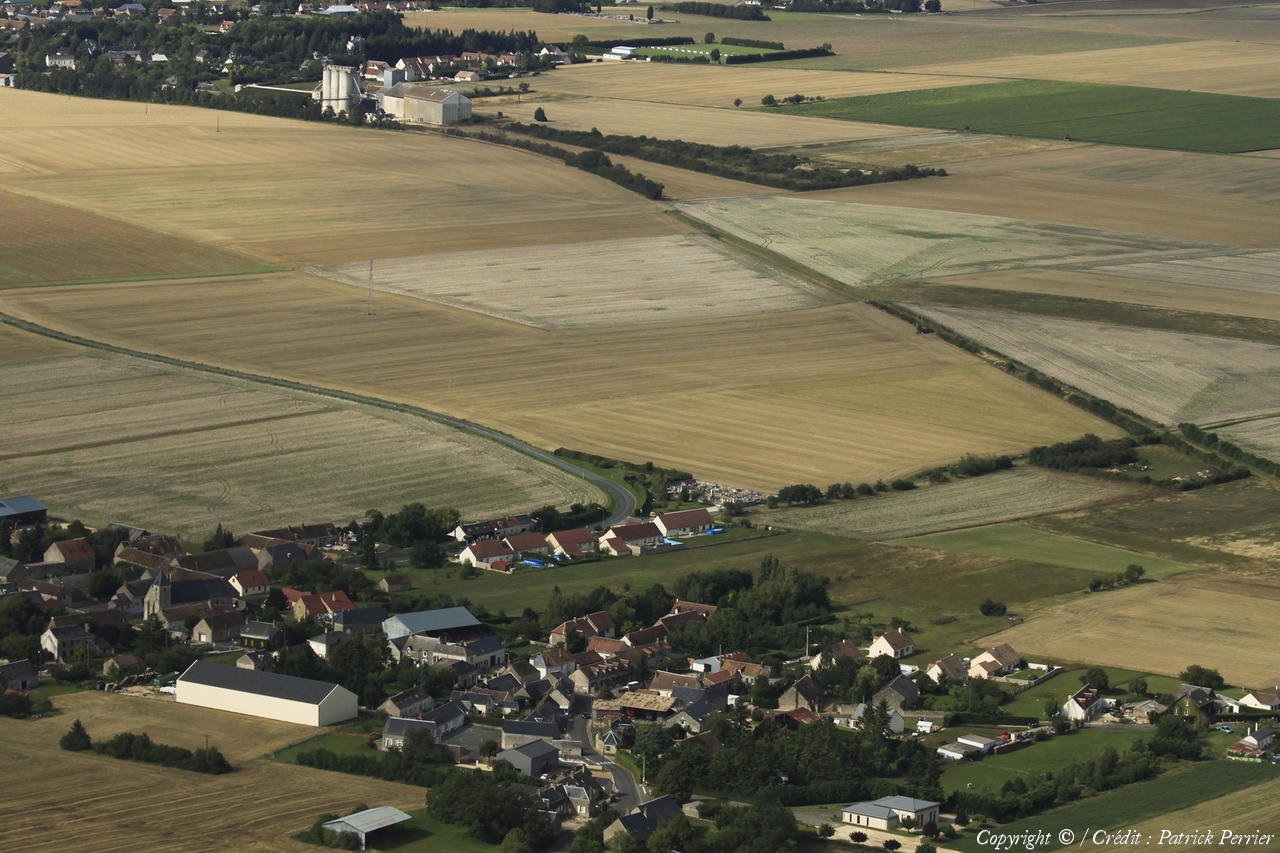
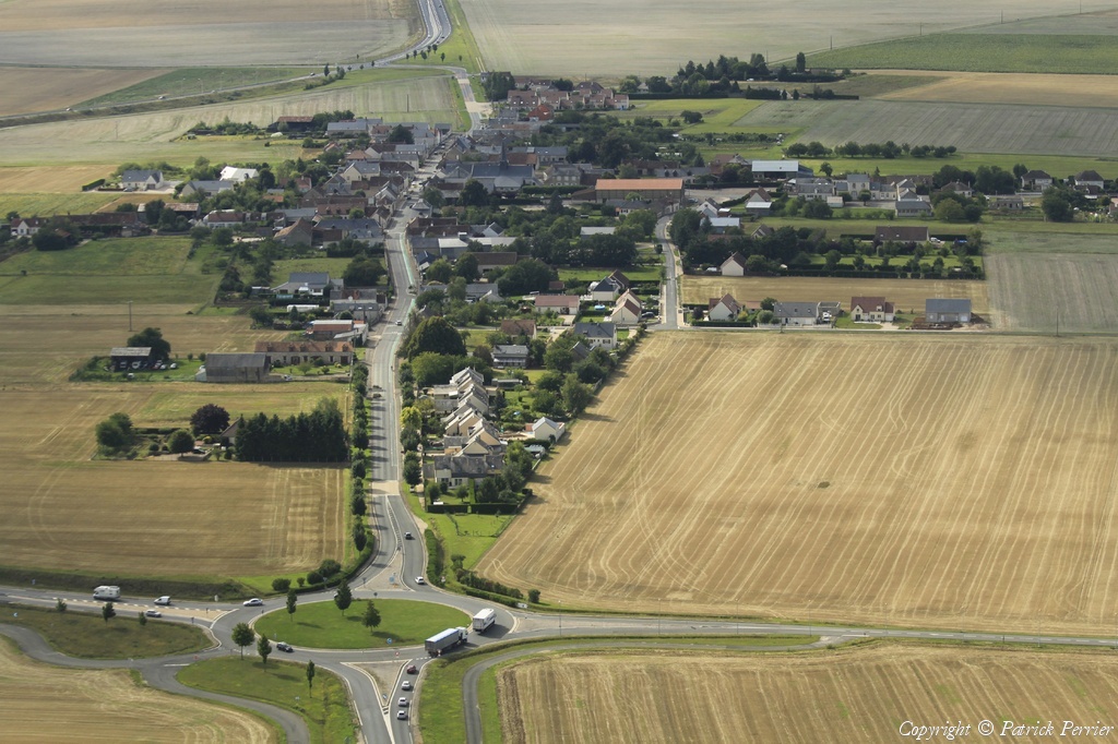
Pays :
France
Département :
Loir-et-Cher (41)
Lieu :
Villemardy
Coord. GPS :
47 43 58 N 01 11 22 E
Photographe :
Patrick Perrier
Prise le :
25/07/2011
Vue 951 fois (
0.80 fois/jour
)
Affiner la recherche
-
Situer sur la carte
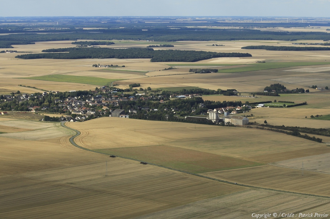
Pays :
France
Département :
Loir-et-Cher (41)
Lieu :
Selommes
Coord. GPS :
47 45 21 N 01 11 35 E
Photographe :
Patrick Perrier
Prise le :
25/07/2011
Vue 1125 fois (
0.95 fois/jour
)
Affiner la recherche
-
Situer sur la carte
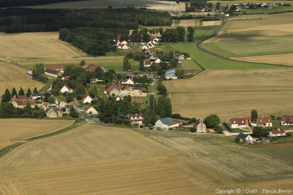
Pays :
France
Département :
Loir-et-Cher (41)
Lieu :
Villefrancœur
Coord. GPS :
47 41 33 N 01 11 52 E
Photographe :
Patrick Perrier
Prise le :
25/07/2011
Vue 1529 fois (
0.43 fois/jour
)
Affiner la recherche
-
Situer sur la carte
Pays :
France
Département :
Loir-et-Cher (41)
Lieu :
Villefrancœur
Coord. GPS :
47 41 58 N 01 12 30 E
Photographe :
Patrick Perrier
Prise le :
25/07/2011
Vue 1585 fois (
0.45 fois/jour
)
Affiner la recherche
-
Situer sur la carte
Pays :
France
Département :
Loir-et-Cher (41)
Lieu :
Saint-Firmin-des-Prés
Coord. GPS :
47 50 53 N 01 06 03 E
Photographe :
Patrick Perrier
Prise le :
25/07/2011
Vue 1518 fois (
0.43 fois/jour
)
Affiner la recherche
-
Situer sur la carte
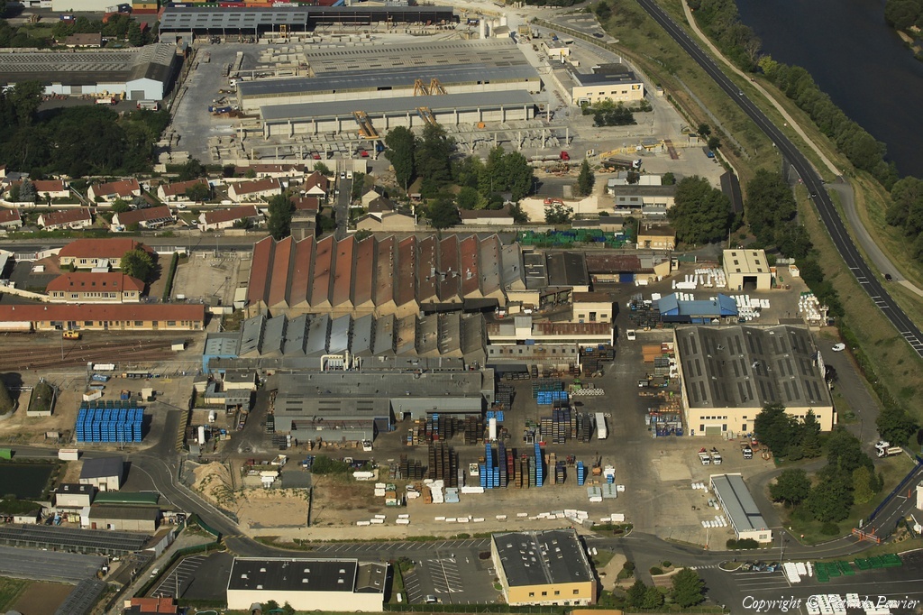
Pays :
France
Département :
Indre-et-Loire (37)
Lieu :
Saint-Pierre-des-Corps
Coord. GPS :
Non disponible
Photographe :
Patrick Perrier
Prise le :
25/07/2011
Vue 1950 fois (
0.42 fois/jour
)
Affiner la recherche
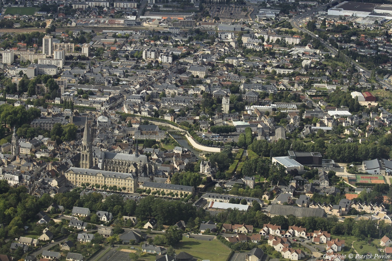
Pays :
France
Département :
Indre-et-Loire (37)
Lieu :
Tours
Coord. GPS :
Non disponible
Photographe :
Patrick Perrier
Prise le :
25/07/2011
Vue 2802 fois (
0.61 fois/jour
)
Affiner la recherche
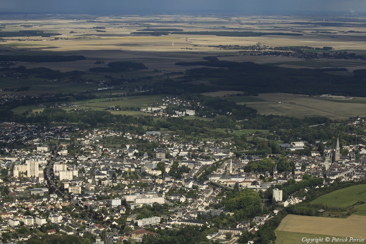
Pays :
France
Département :
Loir-et-Cher (41)
Lieu :
Vendôme
Coord. GPS :
47 47 33 N 01 03 55 E
Photographe :
Patrick Perrier
Prise le :
25/07/2011
Vue 2265 fois (
0.49 fois/jour
)
Affiner la recherche
-
Situer sur la carte
Pays :
France
Département :
Loir-et-Cher (41)
Lieu :
La Chapelle-Vendômoise
Coord. GPS :
47 40 15 N 01 14 17 E
Photographe :
Patrick Perrier
Prise le :
25/07/2011
Vue 1806 fois (
0.39 fois/jour
)
Affiner la recherche
-
Situer sur la carte
Pays :
France
Département :
Loir-et-Cher (41)
Lieu :
Vendôme
Coord. GPS :
47 47 33 N 01 03 55 E
Photographe :
Patrick Perrier
Prise le :
25/07/2011
Vue 2393 fois (
0.52 fois/jour
)
Affiner la recherche
-
Situer sur la carte
Pays :
France
Département :
Loir-et-Cher (41)
Lieu :
Vendôme
Coord. GPS :
47 47 33 N 01 03 55 E
Photographe :
Patrick Perrier
Prise le :
25/07/2011
Vue 2516 fois (
0.54 fois/jour
)
Affiner la recherche
-
Situer sur la carte
Pays :
France
Département :
Loir-et-Cher (41)
Lieu :
Vendôme
Coord. GPS :
47 47 33 N 01 03 55 E
Photographe :
Patrick Perrier
Prise le :
25/07/2011
Vue 2347 fois (
0.51 fois/jour
)
Affiner la recherche
-
Situer sur la carte
Droits réservés - Copyright ©
Survol de France
Site en ligne depuis le 28 octobre 2004
530 visiteurs en ligne
-
910 visiteurs aujourd'hui
Information sur la confidentialité
-
Mentions légales
Mesure d'audience ROI frequentation par


